Airline Highway Park - Park Project
Airline Highway Park Project
Also known as the Baton Rouge Fairgrounds, Airline Highway Park occupies well over 100 acres along US Hwy. 61 at the southern edge of East Baton Rouge Parish where Ward Creek meets historic Bayou Manchac. A park master planning process has been initiated by BREC to upgrade Airline Highway Park to a "Community Park" as defined by BREC's Imagine Your Parks 2 strategic plan. When improvements are made, Airline will be added to BREC's list of 12 Community Parks, filling a gap in outdoor recreation services for residents in the southeast corner of the parish, as identified in the strategic plan.
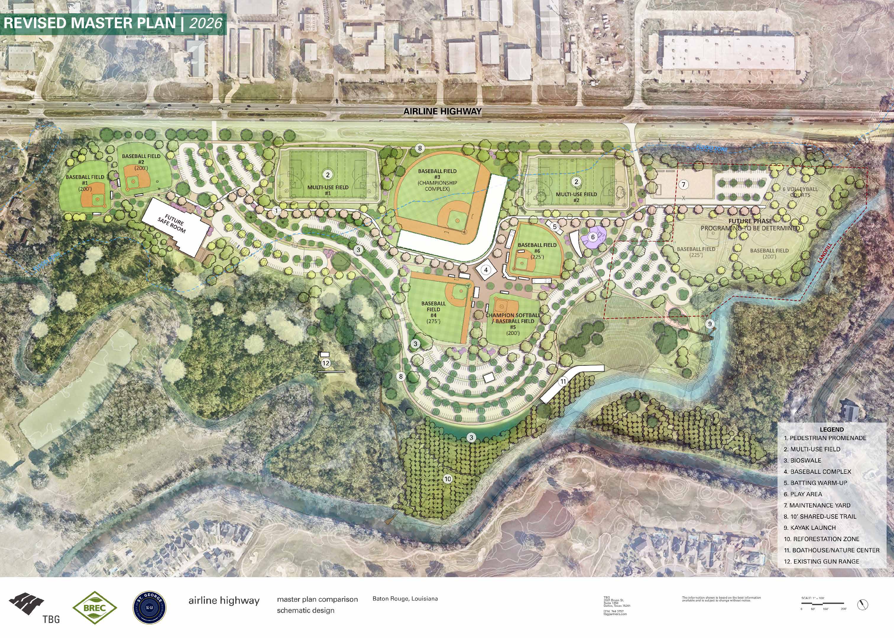
2026 Revised Master Plan
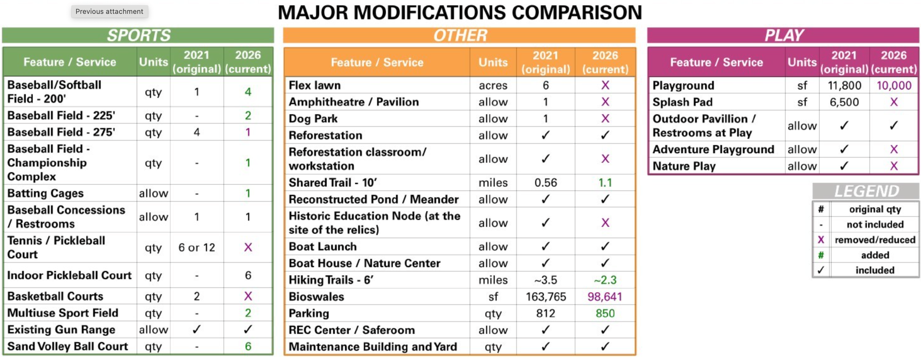
Major Modifications Comparison Chart
2021 Master Plan Presentation
View + Download the Latest Presentation Boards
Project Updates:
- January 2023 - Master Plan and schematic design refinement
- April 2023 - Project in Design Development
- January 2024 - Finalizing Phase 1 Scope
- January 2025 - Commission Approval for FEMA/HMGP Airline Safe Room - Design Team
- March 2026 - Public Meeting in St. George to present the latest Master Plan
- June 2026 - Permitting and City Council Approval of Master Plan and Phase 1
- Phase 1 Construction Document preparation- Summer and Fall of 2026
- Q4 2026 - Bidding of Phase 1 Construction Documents
- Phase 1 Construction anticipated to start in 2027, with an anticipated completion of early 2028 (which we expect to align with the Saferoom construction timeline)
Feedback Opportunities
Help shape the future of St. George’s parks and recreation facilities by providing input on the Airline Highway Park Master Plan and Recreation Transition Plan.
Where is the park?
Visible on the above park map are gravel roads providing access to parking for three youth baseball fields and a playground. A second entry (opposite Paladin Drive on US 61) provides access to the center of the property, including grass fields for the annual Greater Baton Rouge State Fair and to an airgun shooting range nestled in the woods towards Ward Creek. A third access towards the south end of the property provides southbound access to US 61. Current information about Airline Park is available at brec.org/airline
Who is working on this project?
BREC has assembled a team of consultants led by landscape architects at TBG Partners, supplemented by specialists.
- SCAPE Studio – landscape architects
- CSRS – environmental permitting and engineering
- Franklin Associates – public engagement
- Rome Office – architecture
- ETM Associates – recreation facility management
- SURA Inc. – archaeologists
- Costal Environments – environmental scientists
Input Opportunities
More than five stakeholder meetings have been held during the discovery phase of this project. Stakeholders include businesses, industries, and entities located near the park; clubs and groups currently using the park; nearby neighborhood associations; elected officials and other persons having a keen interest in the park.
A pair of open house events were held on Tuesday, November 10th. Public input was received as written comments and as participation in a visual preference exercise featuring possible park amenities. Additionally, an online opinion poll collected over 780 responses.
What We've Learned
Before asking for your comments, we're excited to share what the site inventory and analysis process has revealed so far. This data, including guidance from you - the park users - will inform the development of the park master plan.
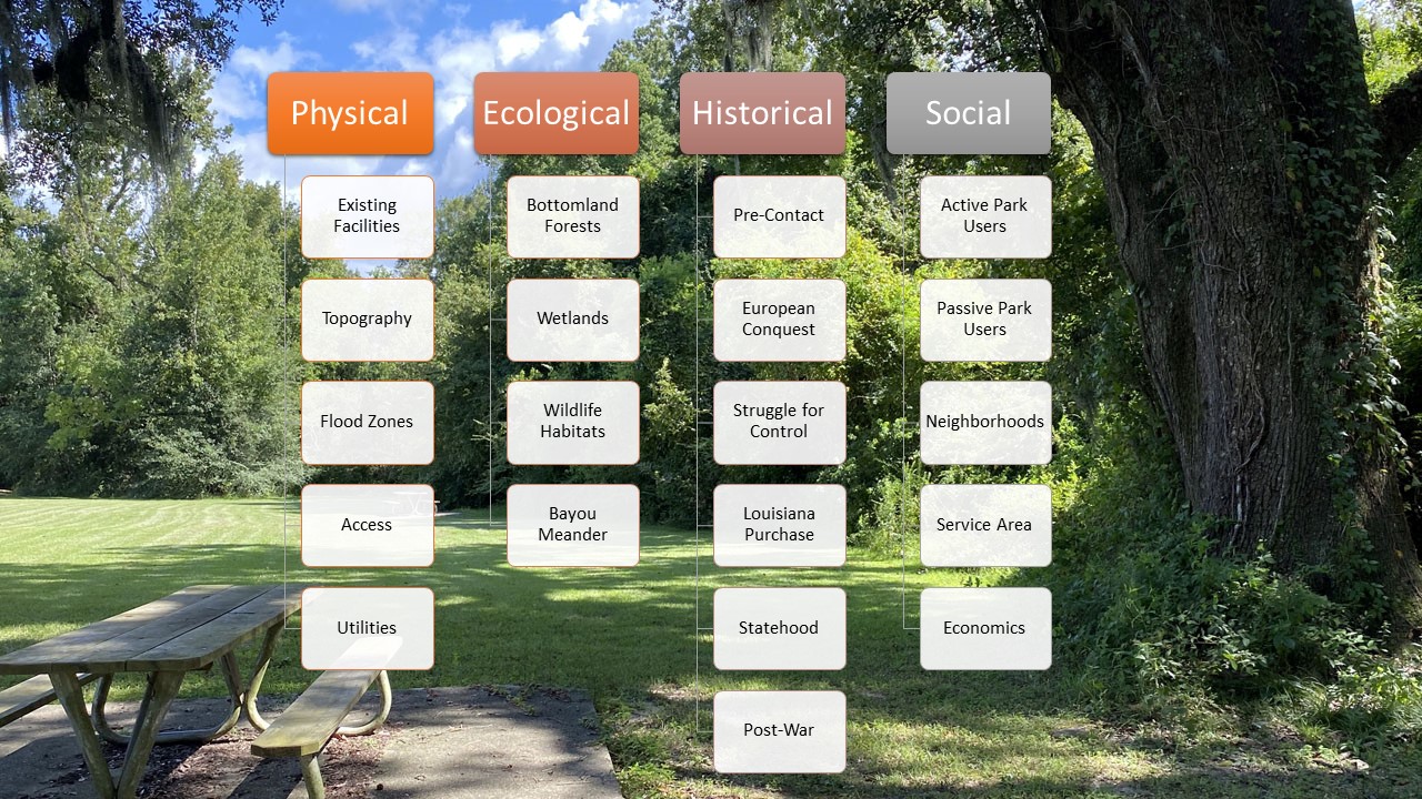
The graphic lists a few of the topics we've researched within each of four categories. Each will be explored more fully - with maps or illustrations - to tell you this story of the park. What we've learned can be grouped into the following categories:
- Physical attributes
- Ecological attributes
- Historical attributes
- Social attributes
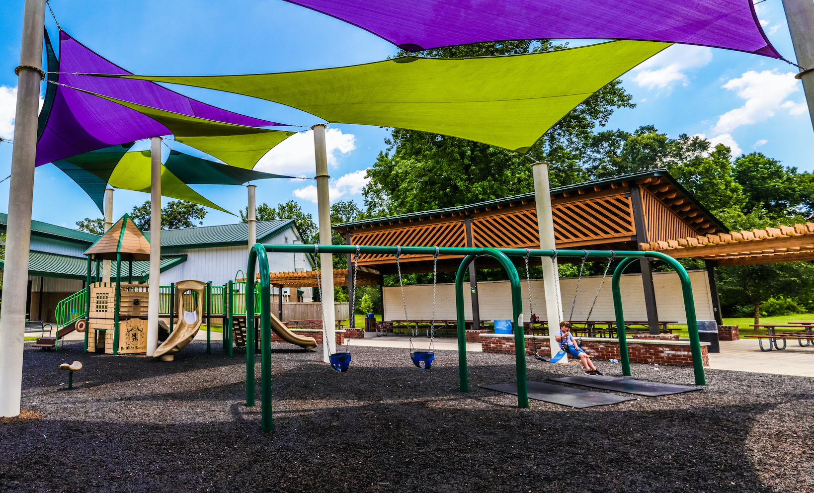
Future Community Recreation Center
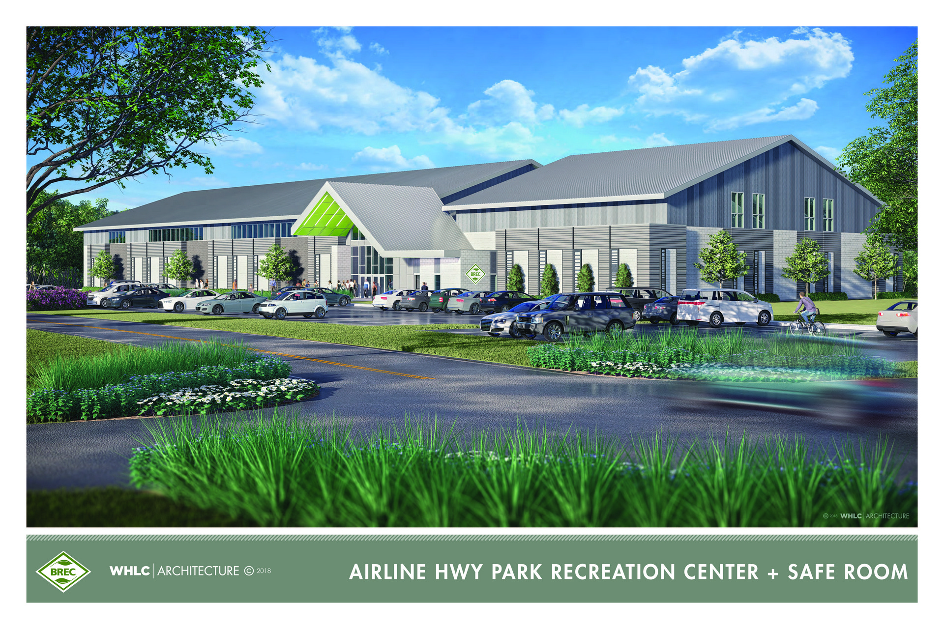
BREC is pursuing a FEMA grant to construct a community safe room at Airline Highway Park. This facility will serve the regional community during catastrophic events such as tropical storms providing resources and housing relief efforts. When not serving in an emergency capacity, the facility will be a community recreation center with flex space. Artist's renderings depict how this facility might look and the graphic below positions it on the park site.